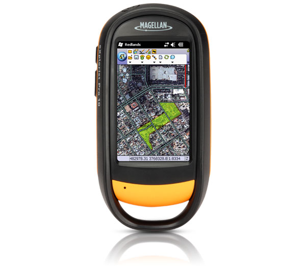
Magellan eXplorist 510 Handheld GPS

Premium, rugged, handheld GPS with camera, microphone, and speaker to record all your actions and navigate the outdoors. Feature rich, innovative and affordable, the Magellan eXplorist 510 has it all: high sensitivity GPS, easy to read maps, accurate navigation, and experience recording.
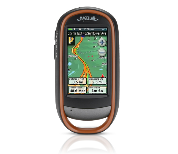
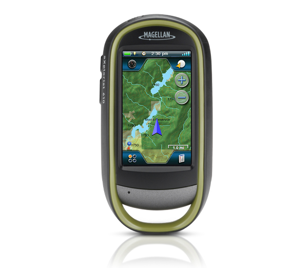
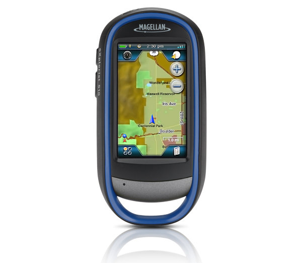
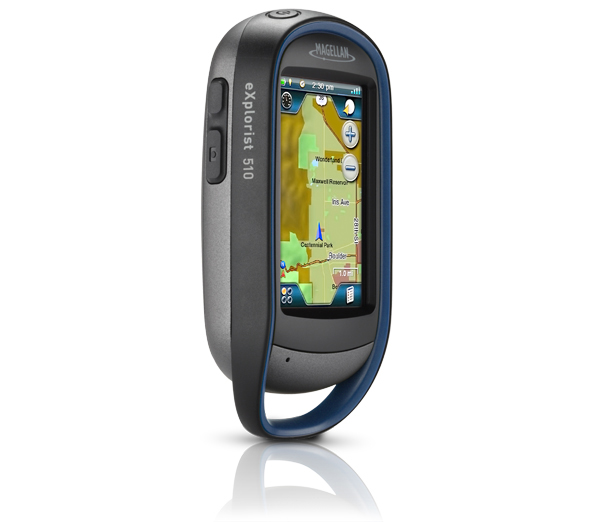
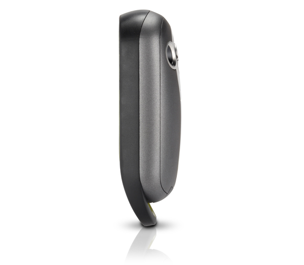
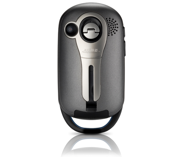
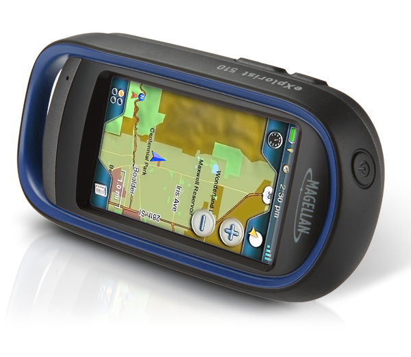
Rugged and waterproof (IPX-7), the Magellan eXplorist 510 combines high sensitivity GPS reception with easy to read mapping and accurate navigation. Find your way using more than 30 navigational data fields. Create waypoints, record tracks, and route from point to point. The integrated 3.2 mega-pixel camera, microphone, and speaker enable outdoor enthusiasts to record geo-referenced images and voice notes. Relive your outdoor adventures on the device, on your computer, or share with others on various online communities like geocaching.com.
Enjoy paperless geocaching with the eXplorist 510. Download and view more than 20 unique characteristics of each cache and view, search, filter on the device. Details include name, location, description, hider, size, difficulty, terrain, hint, and recent logs created by other geocachers.
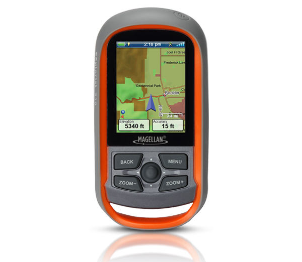
The Magellan eXplorist 510 packs the most accurate maps into the palm of your hand. The World Edition map allows for 2D or 3D viewing angles. It includes a complete road network in United States, Canada, Western Europe, and Australia and major roads throughout the rest of the world and provides cartographic orientation in almost any location. This unique, preloaded map also includes water features, urban and rural land use, and a realistic shaded relief background.
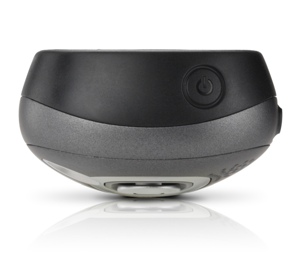
The best of both worlds, the Magellan eXplorist 510 combines the user friendliness of a touch screen with the reliability of two customizable hard buttons. Program the hard buttons to your two favorite or most used functions. Powered by two AA batteries, the eXplorist 510 will last up to 16 hours under normal conditions. To help conserve power, use the suspend mode to turn off the device but maintain GPS tracking. You can also adjust power management settings to your preference.
Magellan’s award winning OneTouch™ favorites menu is now on our handheld devices. It provides instant access to bookmarks of favorite places. Set your home, base camp, and car. Easily re-assign a new location for each new adventure. 12 customizable icons to create personalized searches, save unique locations, or assign quick access to your favorite screens.
[/vc_tab][vc_tab title=”Features” tab_id=”features”]- Core Outdoor Navigation Rugged and waterproof, the eXplorist combines high sensitivity GPS reception with aesthetic mapping and accurate navigation. Find your way using more than 30 navigational data fields. Create waypoints, record tracks, and route from point to point.
- Experience Recording Integrated 3.2 mega-pixel camera, microphone, and speaker enables outdoor enthusiasts to record geo-referenced images and voice notes. Relive your outdoor adventures on the device, on your computer, or share with others on various online communities.
- Superior Maps with 3D Perspective View The eXplorist series packs some of the most accurate maps into the palm of your hand. The World Edition map allows for 2D or 3D viewing angles and covers the globe with details roads and land use areas. Summit Series is a new breed of topographic outdoor maps covering various regions with high level of detail. City Series will add turn-by-turn routing to your handheld GPS receiver.
- 3.0″ Touch Screen and Button Controls The best of both worlds, the eXplorist combines the user friendliness of a touch screen with the reliability of two customizable hard buttons. Program the hard buttons to your two favorite or most used functions.
- Paperless Geocaching Download and view more than 20 unique characteristics of each cache and view, search, filter on the device. Details include name, location, description, hider, size, difficulty, terrain, hint, and recent logs created by other geocachers.
- 16 Hours of Battery Life Powered by two AA batteries, the eXplorist 510 will last up to 16 hours under normal conditions. To help conserve power, use the suspend mode to turn off the device but maintain GPS tracking. You can also adjust power management settings to your preference.
- OneTouch™ Menu Magellan’s award winning OneTouch™ favorites menu is now on our handheld devices. It provides instant access to bookmarks of favorite places. Set your home, base camp, and car. Easily re-assign a new location for each new adventure. 12 customizable icons to create personalized searches, save unique locations, or assign quick access to your favorite screens.
- World Edition Pre-loaded Map The World Edition includes a complete road network in United States, Canada, Western Europe, and Australia and major roads throughout the rest of the world that provides cartographic orientation in almost any location. This unique preloaded map also includes water features, urban and rural land use, and a realistic shaded relief background.
- Navionics® Map Compatibility. Navionics is a world of products that enhance your enjoyment on and off your boat. Simply purchase a Navionics Gold Chart, HotMaps® Premium, or FishN’ Chip Region (sold separately) and plug the SD Card into the eXplorist 510, 610 or 710.
Technical data: Magellan eXplorist 510 Handheld GPS
| Product Number | TX0510SGXNA |
|
DEVICE
|
|
| Dimensions (English) | 2.57″ x 5.04″ x 1.45″ |
| Dimensions (Metric) | 65.3mm x 128mm x 36.8mm |
| Weight (English) | 6.87oz |
| Weight (Metric) | 195g |
| Battery Type | 2xAA |
| Battery Life | 15 Hours |
| Camera | Yes |
| MicrophoneYes | Yes |
| Waterproof | IPX-7 |
| Speaker | Yes |
| Available User Storage | 500 MB |
| CPU | 400MHz |
| Expandable Memory | microSD |
| Temperature Range (F) | 14F to 140F |
| Temperature Range © | -10C to 60C |
| Suspend Mode | Yes |
| Internal Memory | 2 GB |
|
SCREEN
|
|
| Display Resolution, WxH | WQVGA, 240 x 400 |
| Screen Size | 3.0″ |
| Display Type | Color, Transflective |
| Touch Screen | Yes |
|
GPS & SENSORS
|
|
| GPS Accuracy | Up to 3-5 meters |
| High-Sensitivity GPS | SiRFstarIII™ |
| Antenna Type | Multidirectional Patch |
| WAAS/EGNOS/MSAS | Yes |
|
MAPPING & NAVIGATION
|
|
| Preloaded Maps | World Edition |
| Uploadable Maps | Yes |
| Points of Interest | Yes |
| Turn-by-Turn Routing | Yes |
| Vertical Profile | Yes |
| Area Calculation | Yes |
| Hunt & Fish Calendar | Yes |
| Sun & Moon Information | Yes |
| Coordinates Systems & Datums | Yes |
| User Grid | Yes |
| OneTouch Favorites Menu | Yes |
| Audible Proximity Alarms | Yes |
| Silent Proximity Alarms | Yes |
| Navionics® Map Compatible | Yes |
|
USER GENERATED CONTENT
|
|
| Accepts GPX Files | Yes |
| Waypoints | 2000 |
| Routes | 200 |
| Geocaches | 10000 |
| Legs Per Route | 500 |
| Paperless Geocaching | Yes |
| Picture Viewer | Yes |
| Tracks | 200 |
| Points Per Track | 10000 |
| User Data Online Sharing | Yes |
|
INTERFACE & COMMUNICATIONS
|
|
| Communication Protocol | USB Mass Storage |
| USB Port | Yes |
| NMEA Output | Yes |
| PC Compatible | Yes |
Brochure
User Manual
[/vc_tab] [/vc_tabs]About Magellan
Magellan is a leading portable GPS navigation consumer electronics company. Founded in 1986 and with over 200 key patents in GPS technology, Magellan is recognized as an industry innovator and leader. Magellan is the creator of the award-winning Magellan RoadMate®, and Maestro™ series portable car navigation products, as well as the Magellan Triton® and eXplorist® outdoor handheld navigation devices. Magellan is also proud to offer innovative Mobile GPS solutions including the RoadMate App for iPhone and Premium Car Kit accessory.