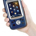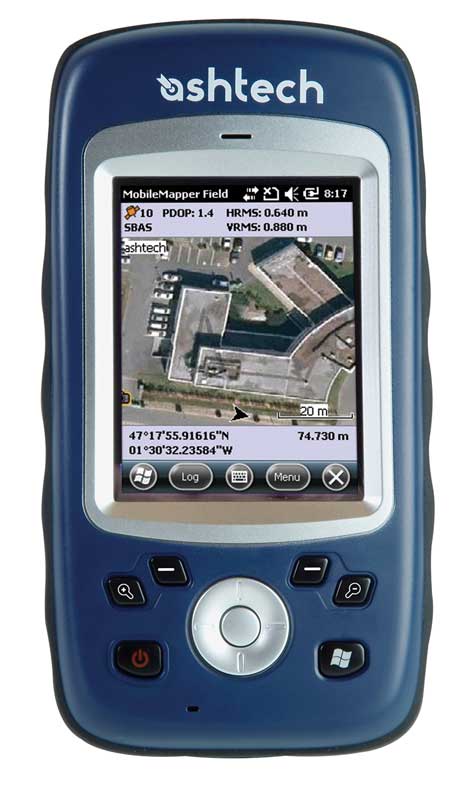
MobileMapper 10
Compact and lightweight, MobileMapper 10 is a complete, easy to use mapping solution for real-time collection of meter accurate data.
With MobileMapper 10, organizations will improve the quality of their georeferenced information and their productivity with direct positive impact on operational costs.
Featured highlights
- Real time meter accuracy
- Ready to use mapping solution
- Integrated communications
- Outstanding battery life
- Ruggedized for professional use
Geographical Information Systems and Location Based Services are strongly penetrating a wide range of applications and organizations. The growing need for geo-localization is naturally boosting the demand for efficient and affordable data collection solutions. Spectra Precision® is leading the GNSS democratization to enable a wider access to professional mapping.
Today with MobileMapper 10, Spectra Precision makes it possible to massively deploy a professional accurate GIS receiver to any field work force.
Boost Your Mapping Productivity with MobileMapper 10
- Log your assets in real-time with meter accuracy
- Connect field and office work force for maximum proactivity
- Reach sub-half meter accuracy with post-processing
Unpack and Start Logging with MobileMapper 10
- Ready to use complete mapping solution for field and office
- User friendly Windows® Mobile 6.5
- Easy-to-use software for short learning curve and quick logging operations
Made For Mobile GIS Work Force
- Compact & lightweight design for optimal mobility, use and comfort
- Integrated communications for easy data transfer
- Only receiver offering several days of battery life
- Ruggedized for outdoor use
MobileMapper Field and Office Software: a complete solution
The Ashetch MobileMapper software suite includes all GIS features that professionals really need without the burden of complicated and rarely used functions, both on field and office sides.
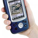
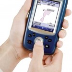
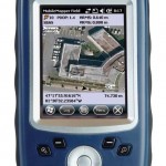
Running on MobileMapper receivers, MobileMapper Field is the perfect solution for GIS data collection, asset management, area measurements, maps creation and updates. The software is very intuitive and easy to use, requiring minimum training. It also provides direct interface to external sensors for a complete solution.
The MobileMapper Office tool can be used to differentially post process raw GPS data collected with the MobileMapper Field software. Through an Internet connection, MobileMapper Office can automatically find and download the base data files that will match the collected raw data; it will compute corrected positions automatically.
Tune MobileMapper 10 with your Applications
With Windows Mobile 6.5 you may upload necessary utilities or software on your MobileMapper 10, to suit your next job. You can collect GIS/GPS points and maps via the GIS application of your choice, either a third party software such as ESRI ArcPad or the proprietary Spectra Precision application.
[/vc_tab][vc_tab title=”Specifications” tab_id=”specifications”]Product specifications
| Constellation | GPS |
| Channels | 20 |
| Frequency | L1 |
| Update Rate | 1 Hz |
| Data format | NMEA |
| Raw data output | No |
| Real-time Accuracy – SBAS mode (HRMS) | 1-2 m |
| Post-Processed Accuracy (HRMS) | <0.5 m |
| Processor | 600 MHz |
| Operating system | Windows Mobile 6.5 |
| Communications | GSM/GPRS, WiFi, Bluetooth, USB |
| Unit size (mm / inches) | 169x88x25 mm |
| Weight | 380 g with battery |
| Display | 3.5 |
| Memory | 128MB SDRAM, 256 MB Flash, Micro SDHC (up to 8GB) |
| Temp Min (°C) | -10°C |
| Temp Max (°C) | +60°C |
| Waterproof | IP54 |
| Shock & vibration | 1,2 m drop |
| Power (type – lifetime) | LiIon, 3000mAh, > 20 hours |
| Antenna Type | Internal / External |
| Firmware options | No |
| Software options | Yes |