Store

  • Out of stock
    Sale!

    Garmin eTrex 20x

     16,990

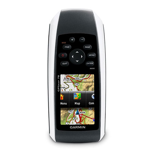
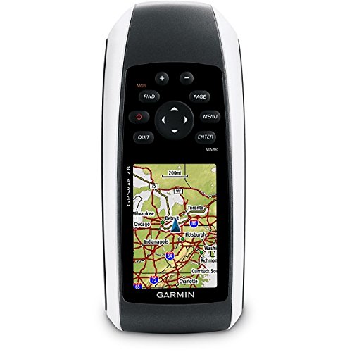
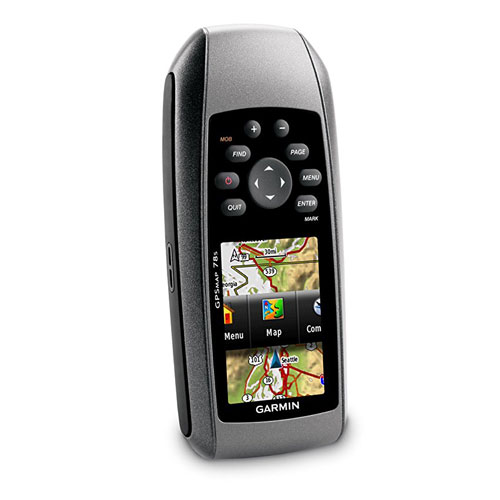
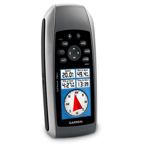
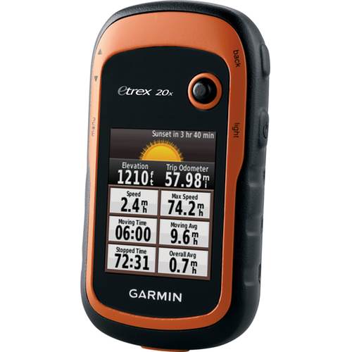
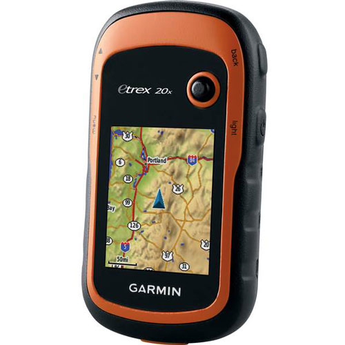
    Garmin eTrex 20x is upgraded version of the popular eTrex 20, with enhanced screen resolution for a more readable display and internal memory expanded to hold more maps. It retains the ease-of-use, durability and affordability that eTrex is legendary for and can also be used on ATVs, bicycles, boats, cars or hot air balloons.

    • Greater resolution with 240 x 320 display pixels for improved readability
    • Internal memory expanded to hold more maps
    • High-sensitivity, WAAS-enabled GPS receiver with HotFix® and GLONASS support
    • 2.2-inch color display
    • Worldwide basemap with shaded relief
    • Paperless geocaching
    • 2000 Waypoints/Favourites/Locations
    • 200 Routes
    • Track Log: 10,000 points, 200 saved tracks
    • 25-hour battery life with 2 AA batteries
  • Sale!

    Garmin eTrex 32x

     32,990
    Garmin eTrex 32x offers ease-of-use, durability and affordability that the eTrex handheld GPS series is known for — along with preloaded TopoActive maps. These devices are perfect for ATVs, bicycles, boats or hiking.
    • 2.2” sunlight-readable color display with 240 x 320 display pixels for improved readability
    • Preloaded with TopoActive maps with routable roads and trails for cycling and hiking
    • Support for GPS and GLONASS satellite systems allows for tracking in more challenging environments than GPS alone
    • 8 GB of internal memory plus a microSD™ card slot
    • eTrex 32x adds a 3-axis compass and barometric altimeter
    • Battery life: up to 25 hours in GPS mode with 2 AA batteries
  • Sale!

    Garmin GPS 12H

     23,990

    Make a splash with the Garmin GPS 12H, a lightweight, water resistant handheld that floats. Simple yet robust, the GPS 12H features high-sensitivity GPS and a USB connection along with its large screen, simple operation and rock-solid performance.

    • Greater resolution with 2.6” diagonal (6.6 cm) display size for improved readability
    • 4 level gray LCD display, easy to read in any light
    • Acquire satellites quickly
    • 1000 Waypoints/Favourites/Locations, 100 Tracks
    • 18-hour battery life with 2 AA batteries (not included)
    • Interface: USB and Serial
    • Physical dimensions: 2.6” x 6.0” x 1.2” (6.6 x 15.2 x 3.0 cm)
  • Out of stock
    Sale!

    Garmin GPSMAP 64s

     25,990

    Garmin GPSMAP 64s features a 2.6-inch sunlight-readable color screen and a high-sensitivity GPS and GLONASS receiver with a quad helix antenna for superior reception. GPSMAP 64s includes a 3-axis electronic compass with barometric altimeter, wireless connectivity and a 1-year BirdsEye Satellite Imagery subscription.

    • Greater resolution with 160 x 240 display pixels for improved readability
    • 4GB Internal memory expanded to hold more maps
    • High-sensitivity GPS and GLONASS receiver with quad helix antenna
    • 2.6-inch, 65K color, sunlight-readable display
    • Worldwide basemap with shaded relief
    • Paperless geocaching, 3-axis compass with barometric altimeter
    • 5000 Waypoints/Favourites/Locations, 200 Routes
    • Track Log: 10,000 points, 200 saved tracks
    • 16-hour battery life with 2 AA batteries
    • Wireless connectivity via Bluetooth® technology¹ or ANT+®
  • Out of stock
    Sale!

    Garmin GPSMAP 78

     20,990

    For boaters and watersports enthusiasts who want to run with the best, the rugged Garmin GPSMAP 78 features crisp color mapping, high-sensitivity receiver, new molded rubber side grips, plus a microSD™ card slot for loading additional maps. And it floats!

    • Greater resolution with 160 x 240 display pixels for improved readability
    • Internal memory expanded to hold more maps
    • High-sensitivity, WAAS-enabled GPS receiver with HotFix® support
    • 2.6-inch, 65K color, sunlight-readable display
    • Worldwide basemap
    • Paperless geocaching
    • 2000 Waypoints/Favourites/Locations, 200 Routes
    • Track Log: 10,000 points, 200 saved tracks
    • 20-hour battery life with 2 AA batteries
  • Out of stock
    Sale!

    Garmin GPSMAP 78s

     32,990

    For boaters and water sports enthusiasts who want to run with the best, the rugged Garmin GPSMAP 78s features a 3-axis compass, barometric altimeter, crisp color mapping, high-sensitivity receiver, new molded rubber side grips, plus a microSD™ card slot for loading additional maps. And it floats!

    • Greater resolution with 160 x 240 display pixels for improved readability
    • Internal memory expanded to hold more maps
    • High-sensitivity, WAAS-enabled GPS receiver with HotFix® support
    • 2.6-inch, 65K color, sunlight-readable display
    • Worldwide basemap
    • 3-axis compass and barometric altimeter
    • Paperless geocaching
    • 2000 Waypoints/Favourites/Locations, 200 Routes
    • Track Log: 10,000 points, 200 saved tracks
    • 20-hour battery life with 2 AA batteries
  • Sale!

    Garmin Montana 680

     65,990

    Garmin Montana 680 features a dual-orientation, color touchscreen that’s glove friendly and includes a 1-year BirdsEye Satellite Imagery subscription. The digital camera provides high-quality images, excellent resolution and automatically geotags photos with coordinates.

    • Greater resolution with 272 x 480 display pixels for improved readability
    • 4GB Internal memory expanded to hold more maps
    • Tracks both GPS and GLONASS satellites
    • 4-inch dual-orientation, glove-friendly touchscreen display
    • 8 megapixel autofocus camera; automatically geotags photos
    • Paperless geocaching, 3-axis compass with barometric altimeter
    • 4000 Waypoints/Favourites/Locations, 200 Routes
    • Track Log: 10,000 points, 200 saved tracks
    • Dual battery system — 3 AA batteries or included rechargeable internal NiMH pack
  • Out of stock
    Sale!

    Hawke LRF Pro 400

     16,990

    Fully multi-coated optical system - BK-7 prisms 6x magnification and an adjustable diopter Ergonomically designed to fit in your hand Twist-up eye cup to ensure proper eye relief Beeline/height/angle mode - accurate to +/- 1m Auto shut off battery save feature

    Measuring Modes:

    • Standard Mode: measures straight line distance to any target in range.
    • Beeline Mode: only measures the horizontal distance to the target.
    • Height Mode: displays the height of a target in relation to the LRF.
    • Angle Mode: measures the angle of projection to half a degree.
    • Height Difference: displays vertical distance between 2 points.
    1 Year Warranty. 
  • Sale!

    Leica CLR290 Clamp Rod

     7,990

    Leica CLR 290 Clamp Rod / Ceiling Pole - for precise marking

    For a precise measurement or levelling task it is important to perfectly position the laser device. Therefore Leica Geosystems offers different types of adapters and clamps for all your application needs.

    This pole is designed for use with the Leica Lino range of line lasers or any other rotating or line laser, for accurate levelling. Simply fix into place between the ceiling and floor upto a height of 290cm and then adjust the clamp to set the height of your laser beam.
    • For step less positioning of lasers at different heights up to 2.90m
    • Universal mounting platform for Leica line and rotating lasers
    • Easy to be fixed e.g. between floor and ceiling
  • Sale!

    At the touch of a button the Leica DISTO D1 measures heights, distances as well as niches quickly and reliably. Complicated or dangerous measurement situations, where ladders may be necessary, are now in the past. The functionality of the DISTO™ D1 can be extended with the Leica DISTO™ sketch app. With this app you can transfer measuring results to smart phones or tablets, process and forward them.

    • Measuring Range: 0.2m – 40m
    • Measuring Accuracy ± 2mm (ISO 16331-1 certified)
    • Bluetooth® Smart for data transfer to smart phones and tablets
    • IP54 dust and splash water protected
    • X-Range Power Technology
    • Quick, simple distance and area measurement
    • FREE Leica DISTO Sketch app
  • Sale!

    The Leica Disto D110 is the smallest and lightest laser distance meter in the DISTO product range. With an ergonomic shape, it fits perfectly into your hand and is effortless to use. The self-explanatory keys ensure operation is quick and intuitive. The precise and affordable laser distance measuring device with only four buttons is deceptively simple to use, and makes measuring distances and areas simple for everybody. The Leica DISTO D110 also benefits from the value-adding features of the Leica DISTO™ sketch app with its built-in Bluetooth® Smart technology.

    • Measuring Range: 0.2m – 60m
    • Measuring Accuracy ± 1.5mm (ISO 16331-1 certified)
    • Bluetooth® Smart for data transfer to smart phones and tablets
    • IP54 dust and splash water protected
    • X-Range Power Technology
    • Removable pocket clip for easy carrying
    • Quick, simple distance and area measurement
    • FREE Leica DISTO Sketch app
  • Sale!

    The new Leica DISTO D2 laser measuring meter is very compact but still powerful. It enables measurements up to 100m at highest precision. A great set of functions like the well-established foldable end-piece with automatic recognition of its position makes the DISTO™ D2 very versatile for many applications. With Bluetooth® Smart it is easy to generate professional documentation which makes communication of your measured data to others very clear and easy understandable.

    • Measuring Range: 0.05m – 100m
    • Measuring Accuracy ± 1.5mm (ISO 16331-1 certified)
    • Bluetooth® Smart for data transfer to smart phones and tablets
    • IP54 dust and splash water protected
    • X-Range Power Technology
    • Clear, illuminated 3 line display
    • Automatic detection of multi-functional end-piece position.
    • Quick, simple distance, area and volume measurement
    • FREE Leica DISTO Sketch app
    • 3 Years Replacement Warranty by Leica Geosystems.

Title

Go to Top